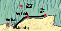
|
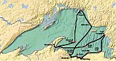
Interactive Map
|
Photos
and Movies
Ecology of Lake Superior aboard the
EPA Research Vessel Lake Guardian
Sponsors
* Western U.P. Center for Science, Mathematics
and Environmental Education
* Michigan Technological University Departments
of Civil & Environmental Engineering, Biological
Sciences, Chemistry, and Education |
|
|
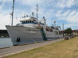
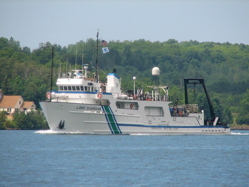
Research
Vessel Lake Guardian provided by the Great Lakes
National Program Office of the U.S. Environmental
Protection Agency |
|
|
Story by Dr. Martin Auer
Department of Civil & Environmental Engineering
Michigan Technological University
Photos and Video by Emil Groth, "Tiger," College of Engineering
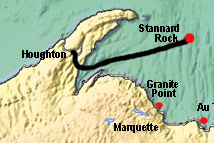
Houghton,
MI to Stannard Rock |
8
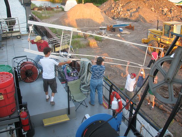
July, 1530 hours to 9 July, 0200 hours: Michigan Tech
to Stannard Rock - with a gentle touch of the
bow thruster, Captain Bob Christensen nestles the 180-foot
R/V Lake Guardian alongside the dock at Michigan Tech;
the adventure begins; loading starts immediately; we
have more gear than the Barnum & Bailey Circus and
the Rolling Stones Pacific Rim Tour put together; spirits
are high; an 0200 departure is scheduled so that we
can be on station at Stannard Rock early in the morning;
some vow to stay up and enjoy the trip out; the old
and the wise go to bed. |
|
|
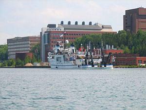
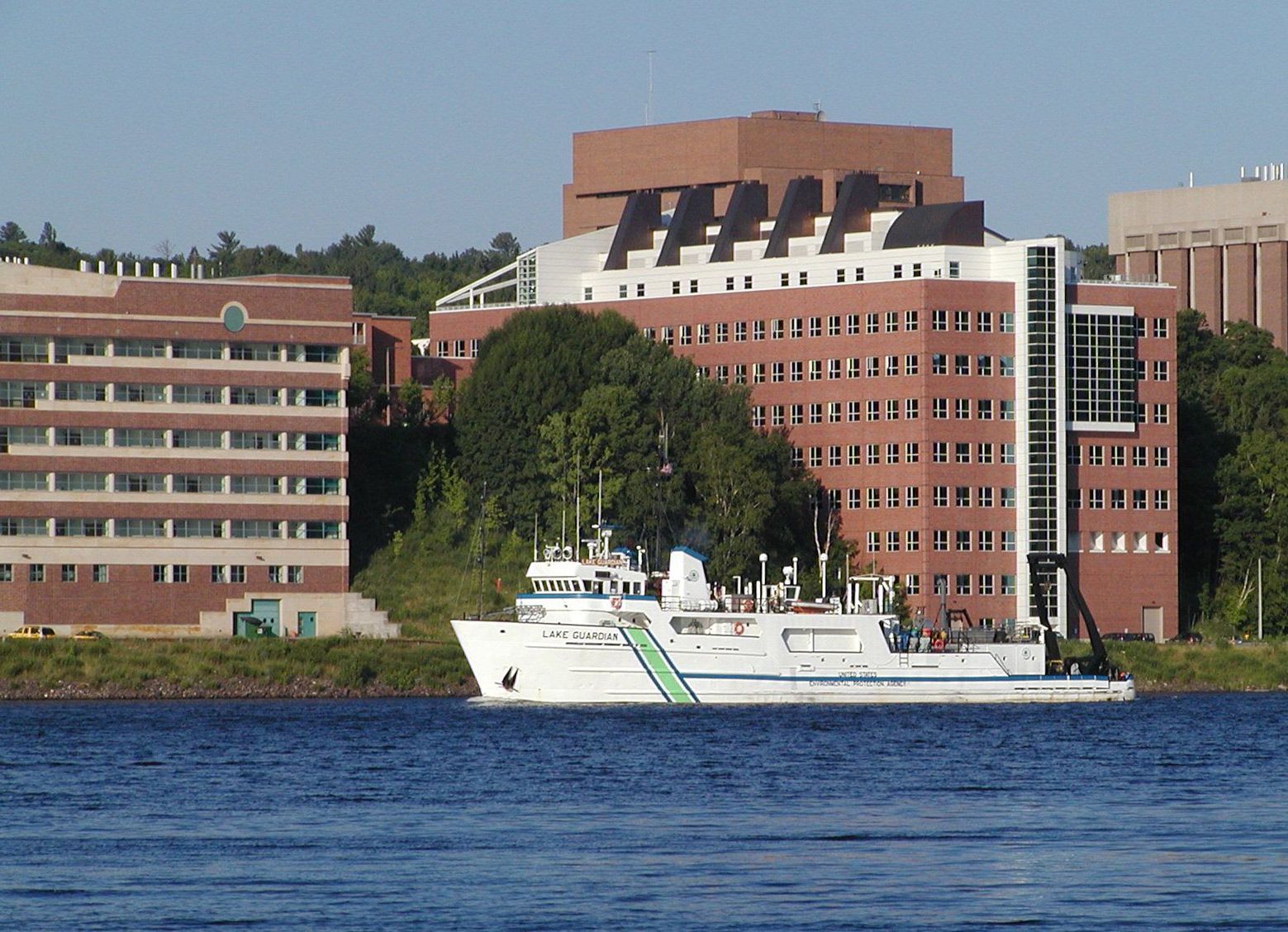
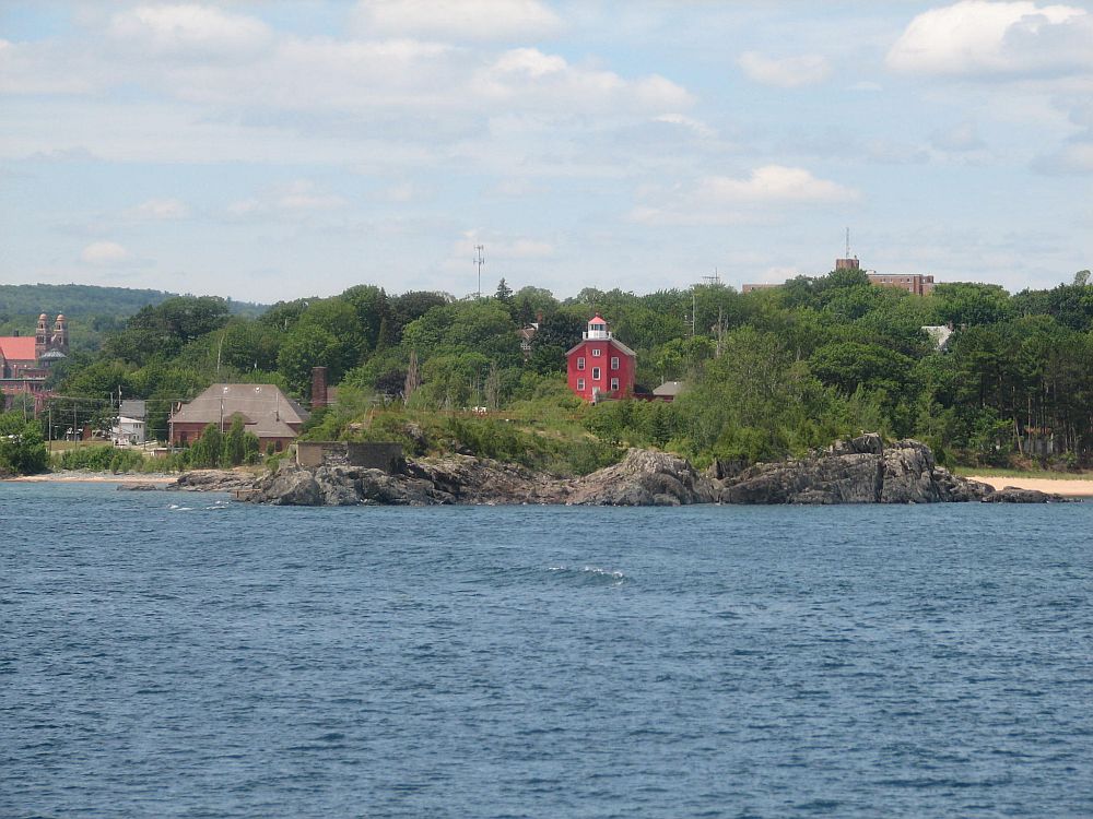
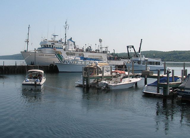
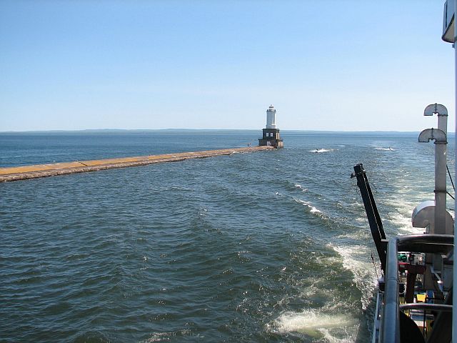
Arrival
of RV Lake Guardian in Houghton, Michigan |
|

|
|
| 
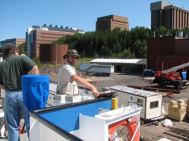
Lead Instructor,
Dr. Martin T. Auer, MTU Professor of Civil & Environmental
Engineering and RV Lake Guardian Captain Bob Christensen Spotlight on: The Ship’s Crew |
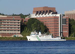
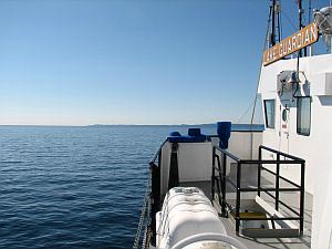
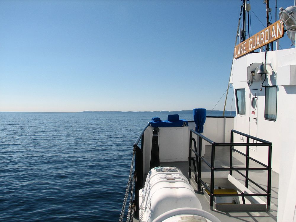
RV Lake Guardian cruising past Michigan Tech
EPA RV Lake Guardian Website |
|
|
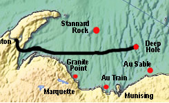
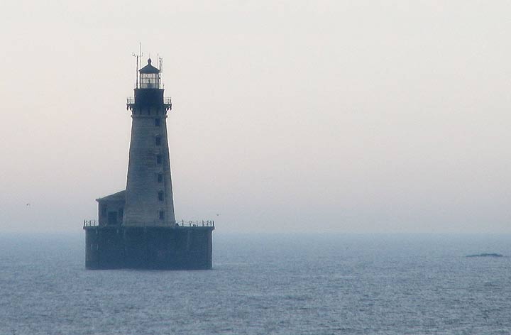
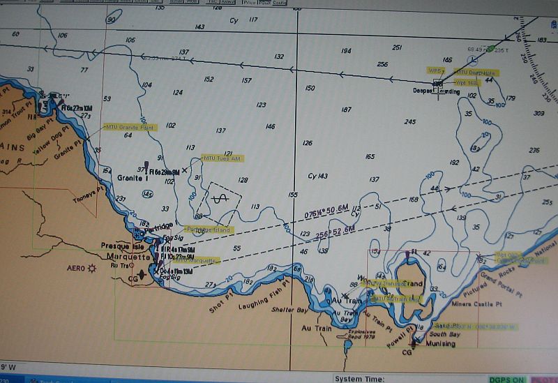
Stannard Rock |
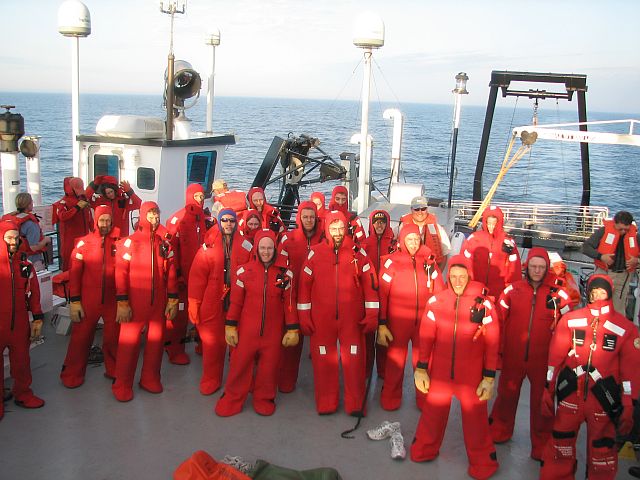
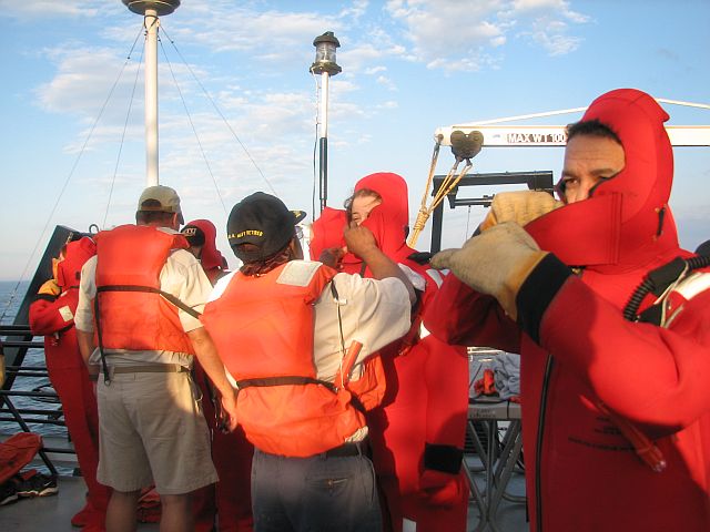
9
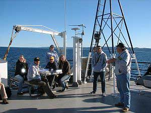
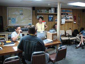
July, 0200 hours to 1200 hours: On Station at Stannard
Rock - left Michigan Tech behind in the night;
awaken in the middle of nowhere, well not exactly, we're
off of Stannard Rock; other worldly; the lake bottom
rises to near the surface from nearby depths of almost
700 feet - a needle of rock in this great lake;
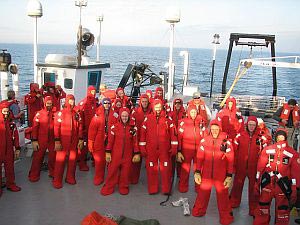
abandon ship drill starts the day at 0700; gumbi suits
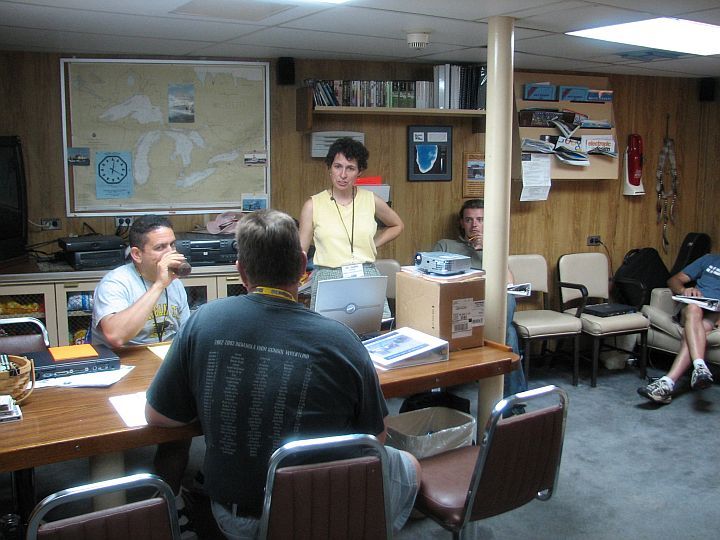
are really hard to get into; humility levels the playing
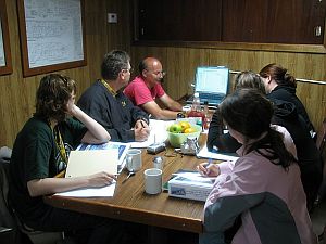
field; after breakfast, course materials are distributed;
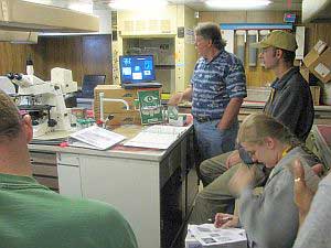
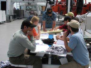
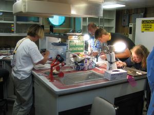
we break into groups for class - lectures in the
galley, the lounge and one of the labs.
Faculty
Photos Students |
|
|
Up
at daybreak
|
|
|

Class materials
|
Dr Alan Weidemann Class about relationship between inherent
and apparent optical properties
|
Dr. Auer's class |
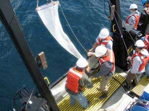
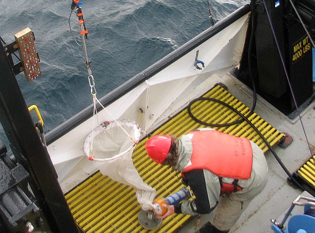
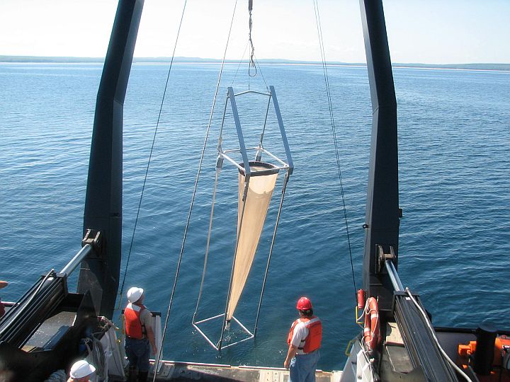
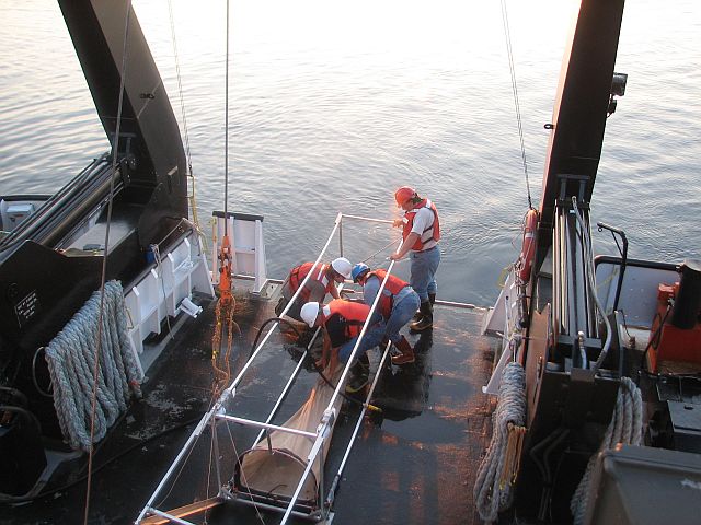
Plankton Net |
Studying on Deck |
|
|
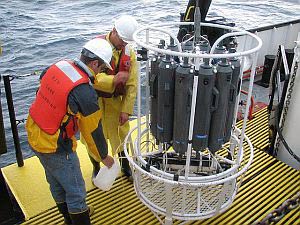
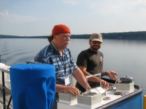
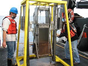
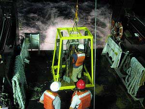
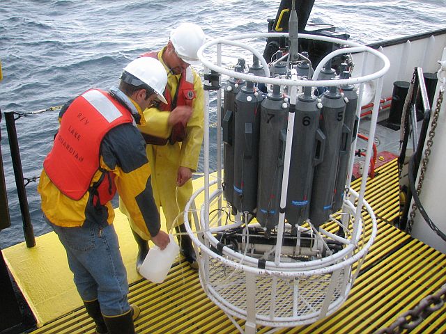
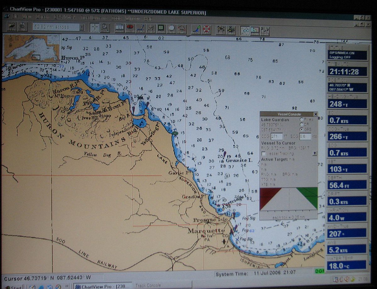
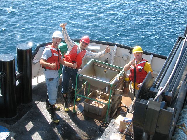
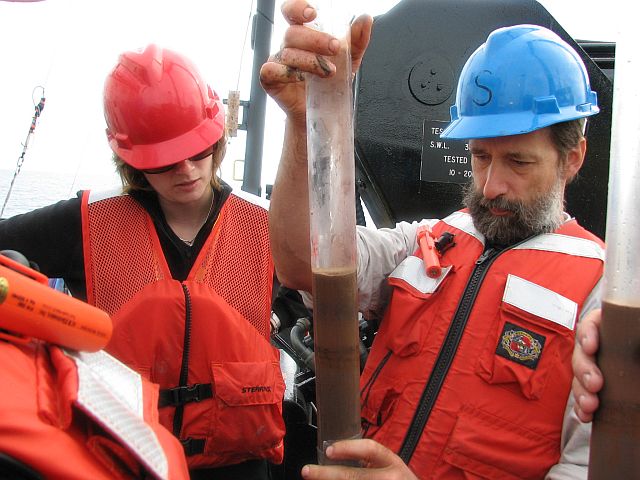
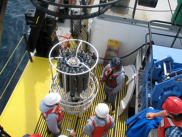
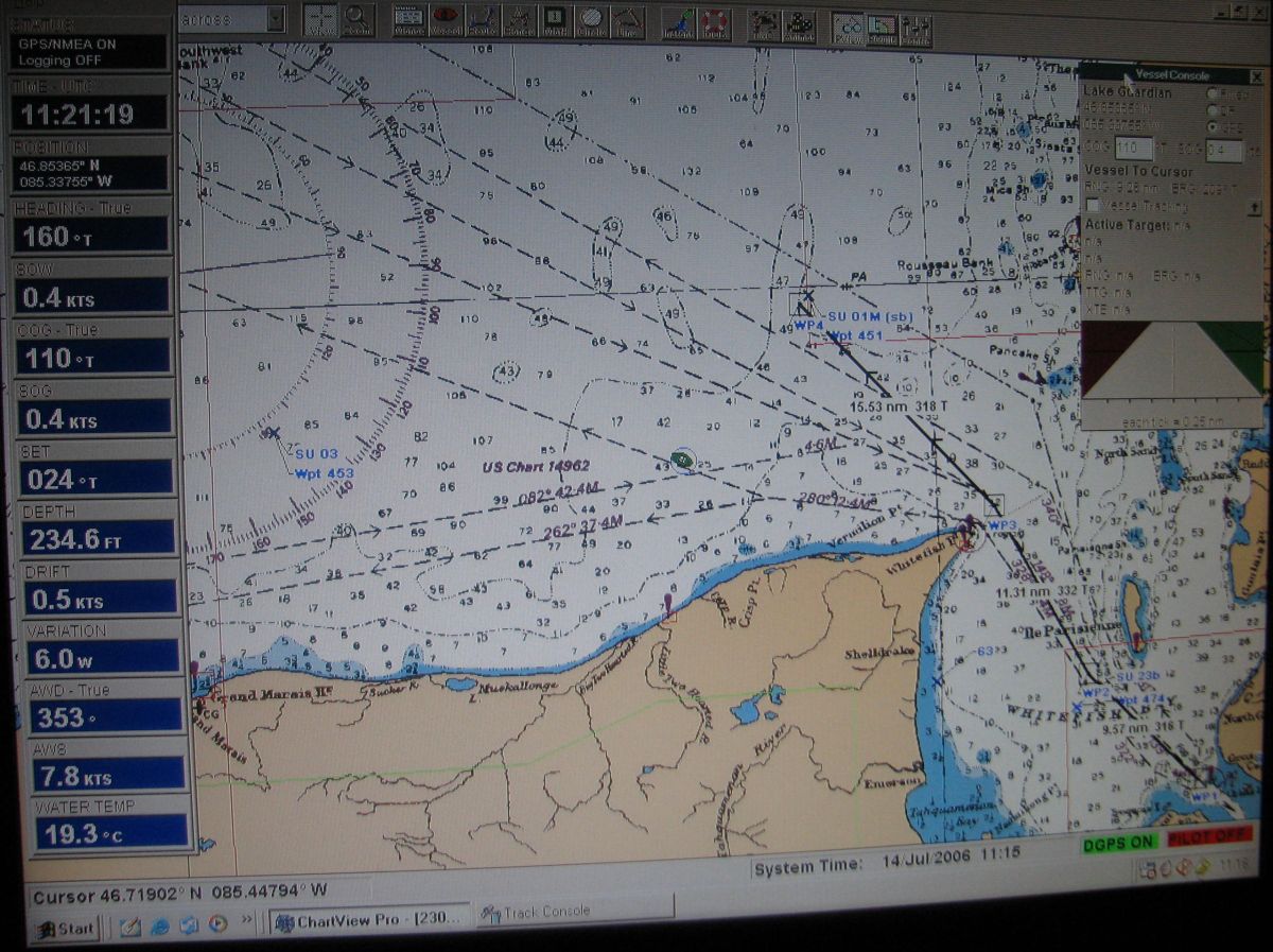
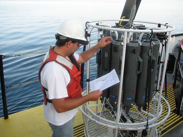
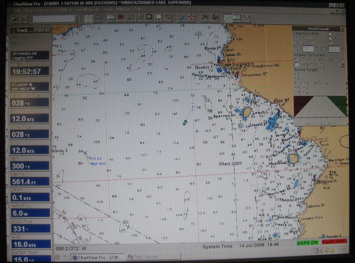
Spotlight on: The CTD and Rosette Sampler
|
|
Across Lake Superior
|
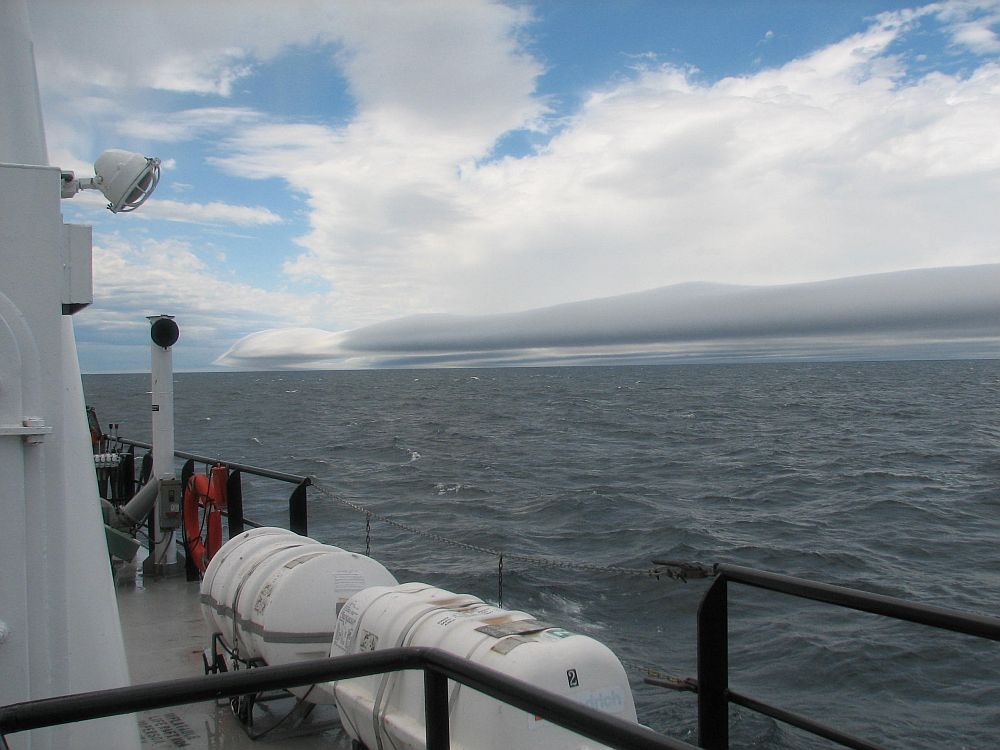
9
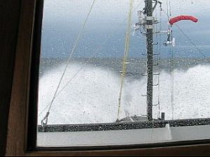
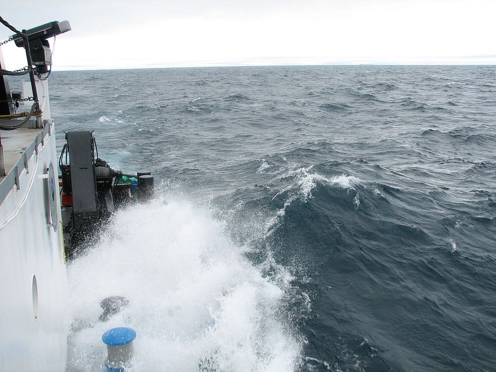
July, 1200 hours to 1800 hours: Across Lake Superior
- we finish up at Stannard Rock with optics measurements;
head across the lake for Ashburton Bay and our first
PONAR dredge transect; bad weather coming in; we later
find out that friends and relatives on shore watching
this storm expected us to be hiding in port; not so;
Captain Bob forges ahead; sensing the spirit of the
day, the lead instructor decides to lecture to the class
in the lounge; no portholes; is that cabbage cooking
in the galley; students are lifting up off of the couch
as we pass over and through the waves; the operative
color is green.
Crossing Lake Superior aboard RV Lake Guardian Video
12 Mb WMV (Long in transit video)
|
|
| 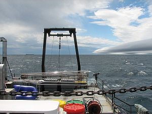
Storm
approach |
|
|
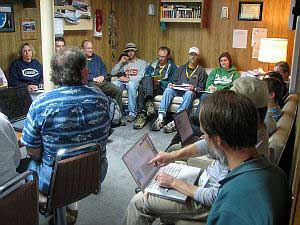
Class Meeting |
Optics: Spotlight on Optics |
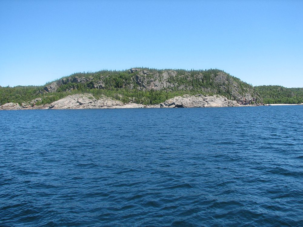
|
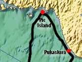
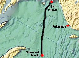
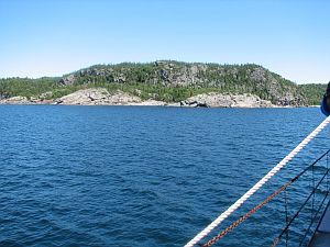
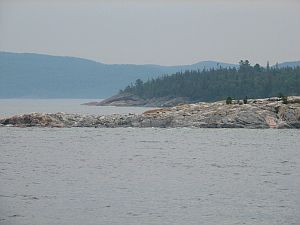
Pic
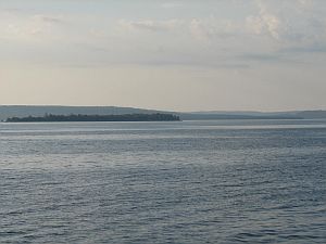
Island - Ashburton Bay
|
9
July 1800 hours to 10 July 0500 hours: On Station at
Ashburton Bay - we arrive off Pic Island near
Ashburton Bay at sunset; our goal is to collect bottom
sediment samples, in triplicate, at nine stations along
an onshore-offshore transect with depths ranging from
15 to 200 meters; we're in the lee of the Canadian
north shore here and the waves have calmed considerably;
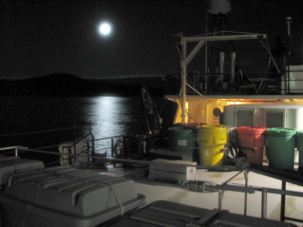
the moon is up in the hills to the east; this is going
to be a long night; in the morning we head off to our
second transect at Point La Canadienne near Pukaskwa. |
|
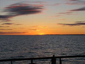
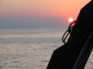
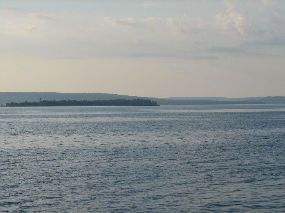
Sunset,
looking NW, 7
nautical miles SSW of
Pic Island, Ontario, Canada |
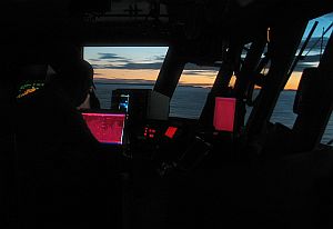
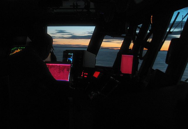
Sunset
near Pic Island view from the bridge |

Research
Vessel Lake Guardian
Somewhere in far north of Lake Superior . . . .
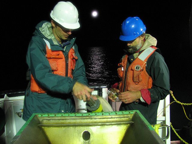
Ponar
Science Video 7Mb
Ponar
Science Movie High Resolution 12Mb |
|
| |
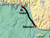
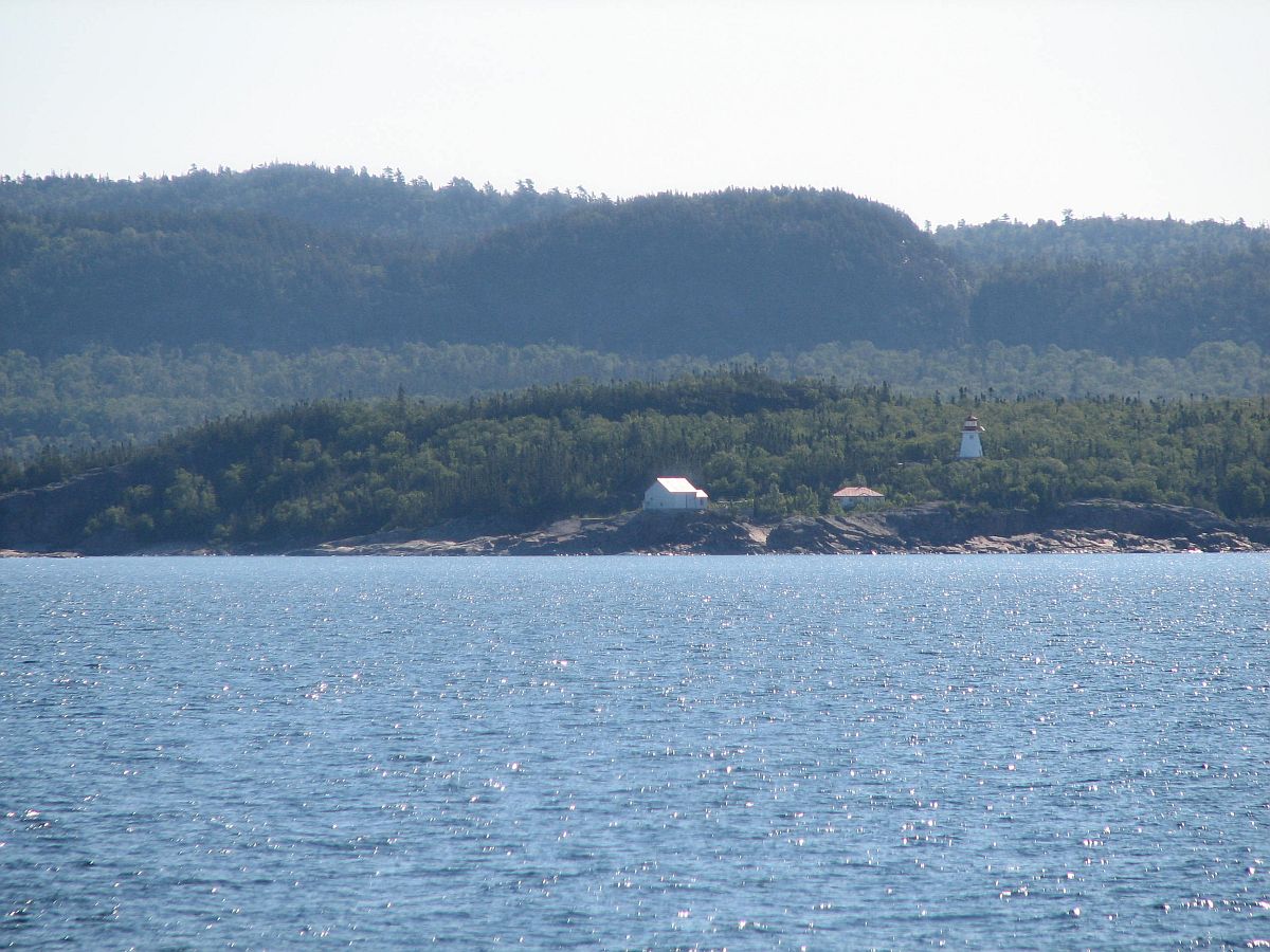
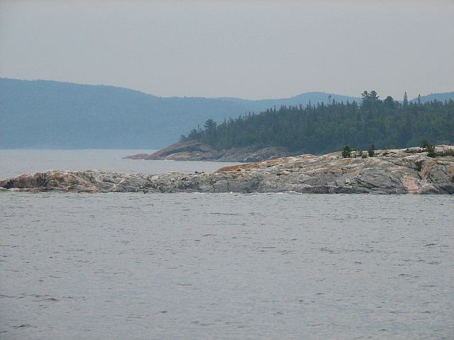
Pukaskwa
|
10
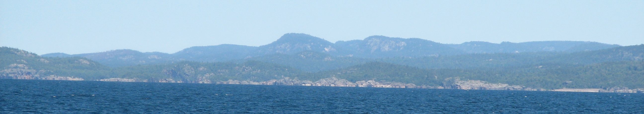
July 0500 hours to 1900 hours: On Station at Pukaskwa
- spectacular shoreline vistas; Michipicoten
Island is visible in the distance; this is a busy
station with plankton, optics and box-core sampling;
classes are running in parallel; this is also our
second PONAR transect; long day and into the night;
tomorrow its back across the lake to Marquette to
exchange some of our faculty.
In transit Lake Superior aboard RV Lake Guardian Video
12 Mb WMV (Long in transit video)
|
|
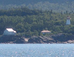
Pukaskwa
Area, Otter Island light |
Michipicoten
island in distance |
Pukaskwa
Coast |
Pukaskwa
Area
WMV
Movie Clip 3 Mb
Another
coastal view 1 or 2 |
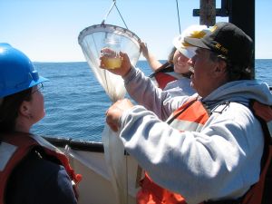
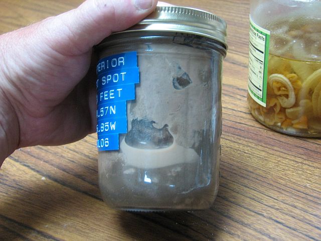
Dr.
Martin Auer, Lead Faculty for the course, Department of Civil
& Environmental Engineering: looking at a mason jar with
the contents captured by the plankton net.
Pukaskwa
Plankton Net Video WMV 2.9 Mb |
|
|
|
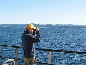
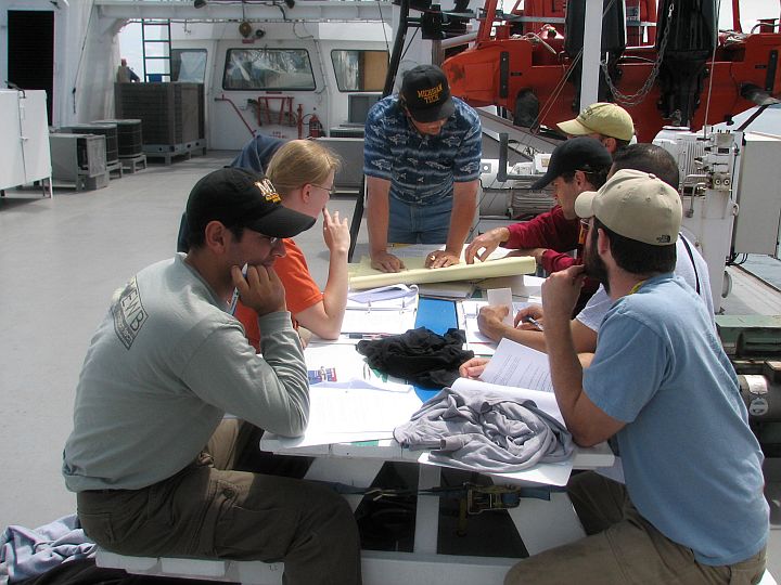
Class discussion on Deck of RV Lake Guardian |
Rosette on Deck of RV Lake Guardian |
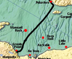
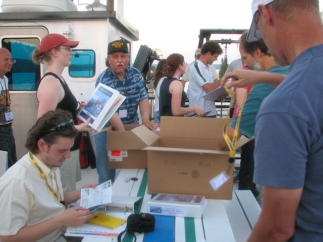
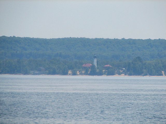
Marquette |
10
July 2300 hours to 11 July 1300 hours: Shore Stop at Marquette
- back across the lake; much nicer weather then for
the trip over; we're bound for Marquette where we will
exchange faculty and scientists; also an opportunity for an
ice cream, to talk with visitors and to briefly meet family
and friends that have come down to the docks.
Lake Superior aboard RV Lake Guardian - Marquette Harbor to Sunset Video
5 Mb WMV ( in transit video)
|
|
In
transit WMV Movie 1Mb |
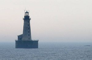
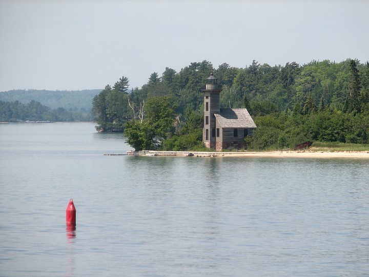
Marquette
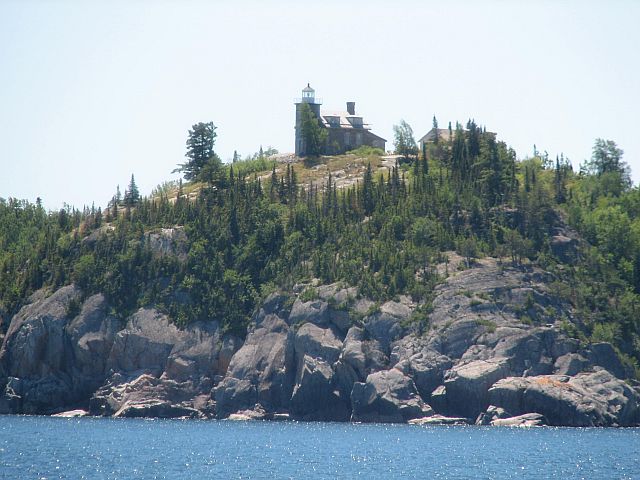
light |
|
At
Marquette |
In
transit WMV Video 1Mb
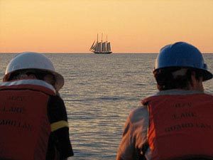
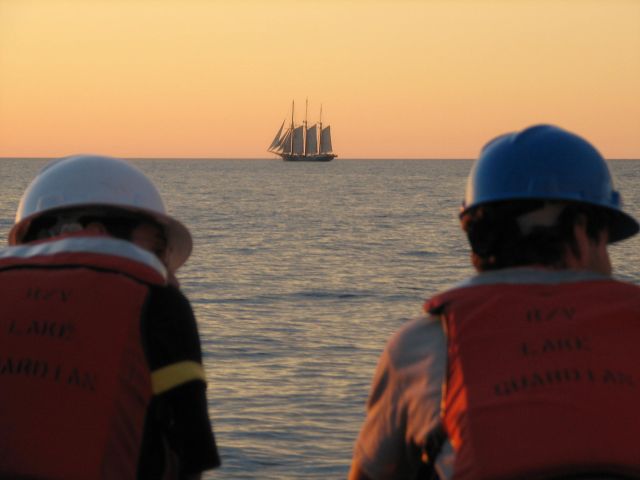
SV Denis
Sullivan on Lake Superior |
|
|
Granite Point
|
11
July 1500 hours to 12 July 0200 hours: On Station at
Granite Point - we depart Marquette and head west
over toward the Huron Mountains, on station at Granite
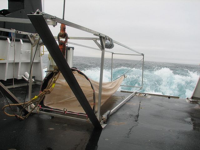
Point, our next PONAR transect; we'd like to try
out the benthic sled here but are fearful of getting
hung up in the rocks, so we'll wait for the sandier
waters of AuTrain Bay; another spectacular spot and
a successful transect; things are going well. |
|
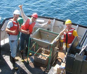
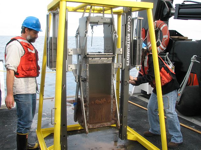
Granite
Point Box Core
Granite
Box Core Video WMV 3.5 Mb
More
Details about box core WMV Video 4.5 Mb |
|

Dr. Noel
Urban inspects a core from the Box Corer, note how the core
captures and preserves the sediment layers and the surface. |

Marquette
Granite Point rosette
|
|
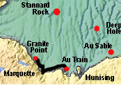
Au Train
|
12
July 0200 hours to 13 July 1000 hours: On Station at
AuTrain Bay - from the cold, rocky shores of Granite
Point, we head to the shallow, sandy, warmer waters
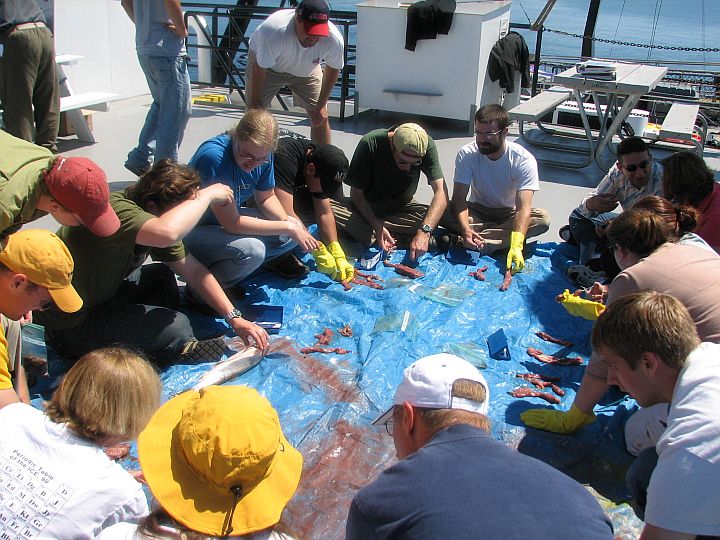
of AuTrain Bay; we expect this to be a productive region,
excellent for observing Diporeia, and a perfect environment
for working with the ROV. We have a great deal of work
to do here in addition to ROV deployment. We will be
doing work with fish and will be towing the benthic
sled. This will be our longest time on station for the
cruise. |
|
Au Train
Island
|

Dr
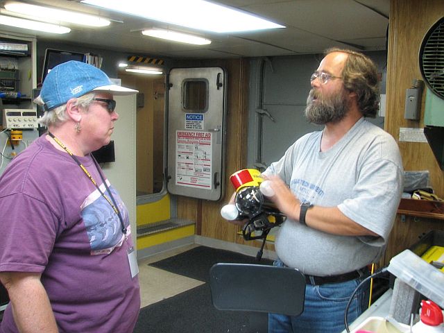
Nancy Auer and Mark Gleason: Video Ray underwater robot camera
|
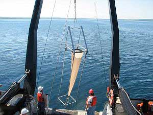
Benthic
sled on fantail
|
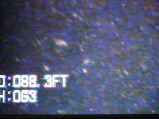
Zooplankton high density at 88 ft |
|
|
Munising
|
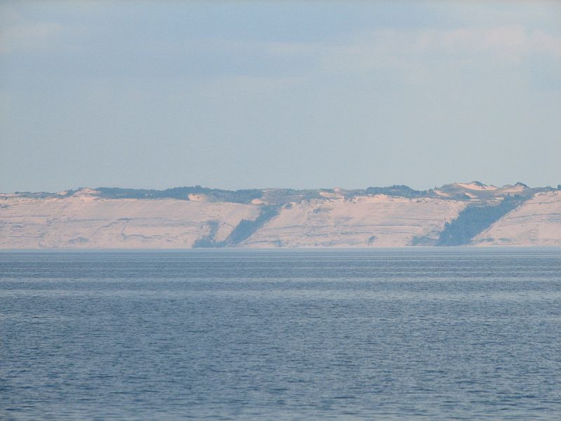
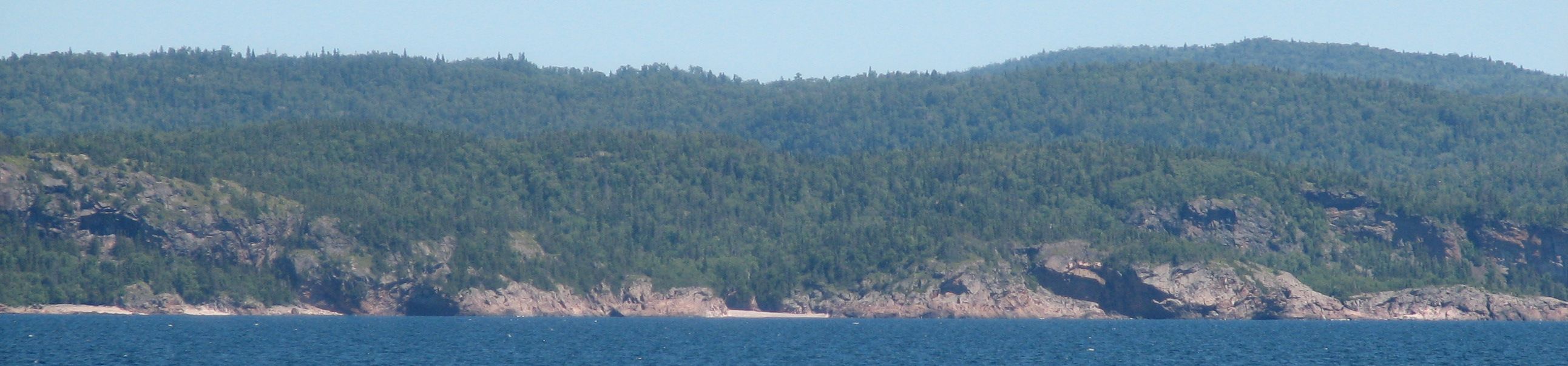
13
July 1000 hours to 13 July 1200 hours: Shore Stop at
Munising - another quick stop to exchange faculty
and scientists; a beautiful ride in around the islands
between AuTrain Bay and Munising; visit with folks walking
the docks and a few family and friends, then we head
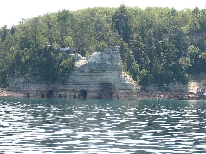
out to the east; the Pictured Rocks are fantastic, a
first look for many of us; then down to AuSable Point,
Grand Sable Dunes and on to our next station off Little
Lake Harbor. |
|

Munising Harbor
|
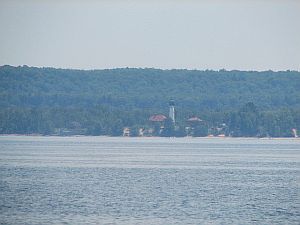
|
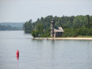
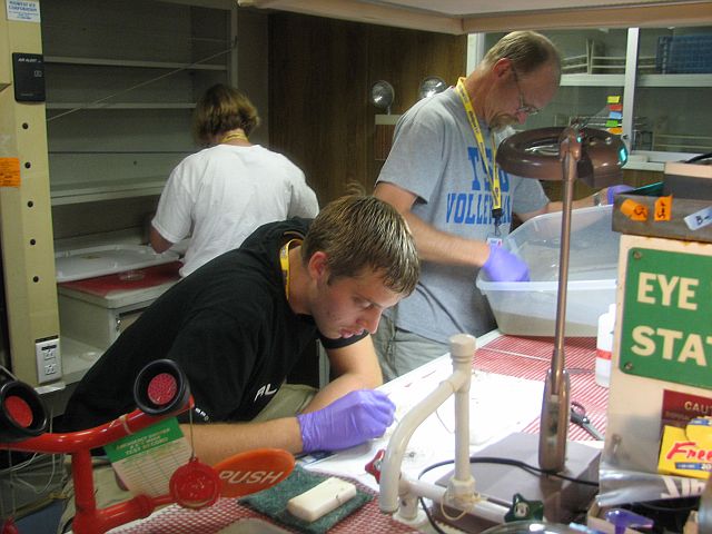
Munising Bay - Pictured
Rocks lighthouse
|
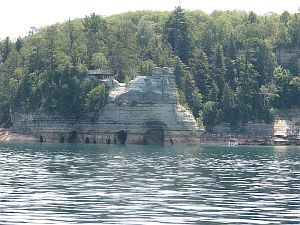
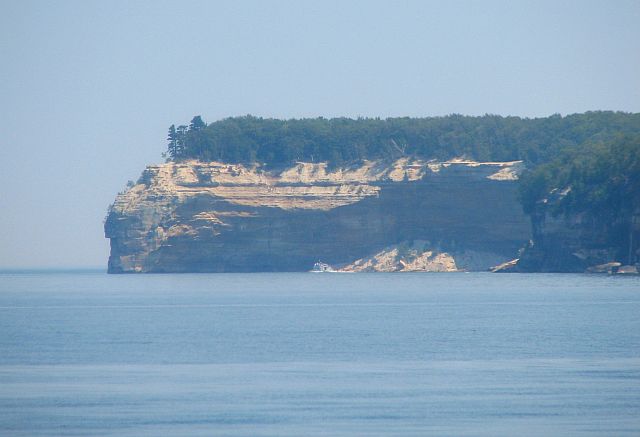
Pictured
Rocks
|
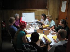
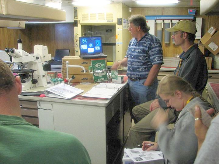
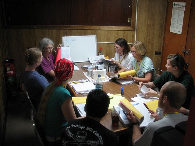
The
ecology course included classroom sessions, shown here with
Dr. Green
|
Participants
are busy working in one of the ship's labs, their research
to see that whitefish and lake trout have enough biomass food
to prosper.
Click for Lab Video WMV
2 Mb
|
|
|
Au Sable
|
Just passing through, but what a wonderful view!
|
|

Grand
Sable Dunes
|
Au Sable
Point Lighthouse
|
Ship's
Galley
|

Fish Class on Deck |
|
|
Little Lake Harbor
|
13
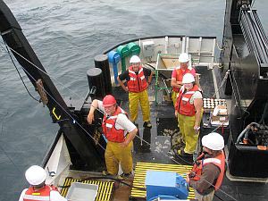
July 1200 hours to 13 July 2330 hours: On Station off
Little Lake Harbor - one of our most beautiful
rides and one of our busiest stations; PONAR transect,
box cores and benthic sled tows; the first sled tow
was nice and clean (no bottom hang-ups), but didn't
catch much; captain thinks it was too far above bottom;
deck hands work to modify the collection height; disaster;
we catch a ton of sand and tear the net in two places;
deck hands do a magnificent job of mending the net and
it is re-adjusted to an intermediate collection height;
now we're talking; a bountiful collection of Diporeia
and Mysis! |
|
Offshore Little Lake Harbor
|
Offshore from Little Lake Harbor, Lake SuperiorArea Box core at night
|

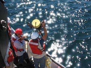
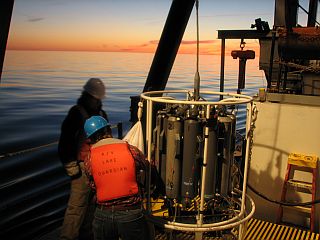
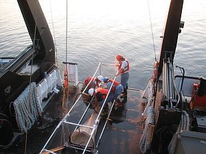
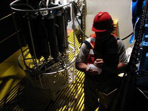
Rosette
collects water samples at various levels for chemical analysis,
data sheet shows the descent and when bottles open to collect
sample at a specific depth
Click for Rosette
Video WMV 3.8 Mb |
Benthic
Sled offshore from Little Lake Harbor area
Little
Lake Harbor Benthic Sled WMV Video 4 Mb
Little
Lake Harbor Benthic Sled WMV Hi-res Movie 6.8 Mb |
|
|
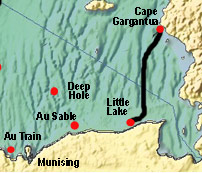
Cape Gargantua
|
13
July 2330 hours to 14 July 2330 hours: On Station off
Cape Gargantua - on the way from the Little Lake
Harbor station, we run three air sampling transects,
each about 2 hours in duration; the winds are favorable
for air sampling and the scientists are pleased; on
station at Cape Gargantua we experience another dramatic
change in the character of the shoreline; we're
back to rocks; beautiful topography; it's so rocky
though that we can't get a PONAR sample at our
first three stations; the dredge just bounces off of
the rock; eventually we're successful in collecting
PONAR samples and it's off to the Deep Hole! |
|
Near Cape
Gargantua |

Cape Gargantua
Benthic Sled
Cape
Gargantua Benthic Sled WMV Video 3.4 Mb |
Dr Judith Perlinger class session aborad the researtch ship |
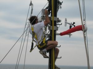
David
Tobias on the ship's mast checking air monitoring equipment |
Cape
Gargantua ponar transects Video WMV 3.3 Mb
Cape
Gargantua ponar transects hi-res Movie WMV 7 Mb
Near Devil's
Wharehouse Island |
|
|
|
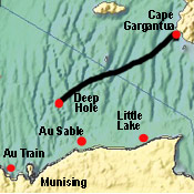
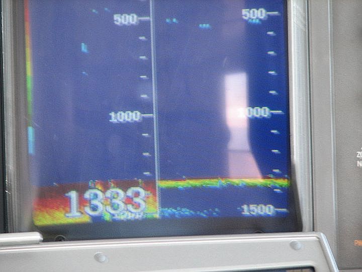
Deep Hole
|
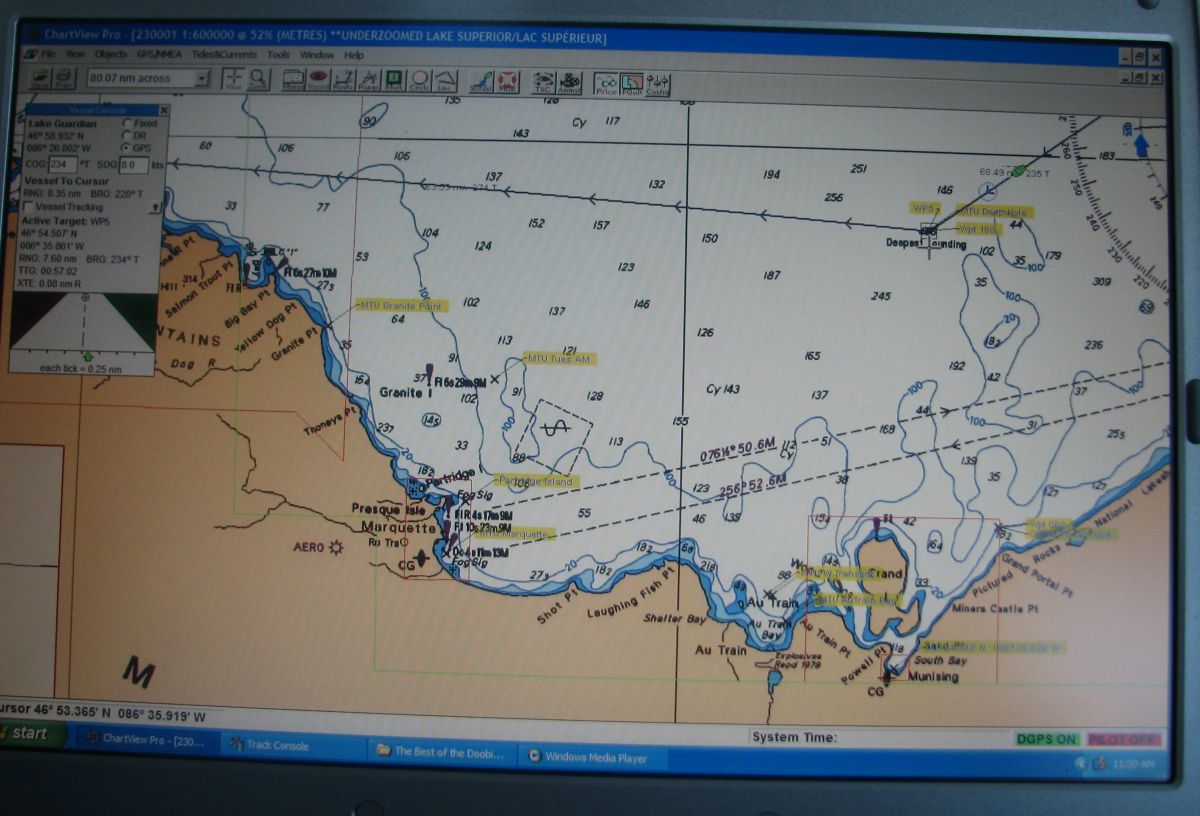
14
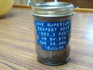
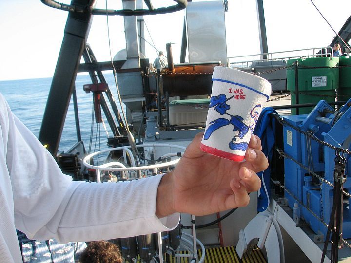
July 2330 hours to 15 July 0800 hours: The Deep Hole
- Superior is the largest lake in the world by
surface area, and contains over 13% of the freshwater
presently held in the world's lakes; at over 1300
feet, it is also among the deepest lakes; we're
going to have some fun here, sending a bag of Styrofoam
coffee cups, adorned with original art, down to the
bottom of the ‘deep hole'; pressure does
its work, forcing the air out of the styrofoam and the
cups come back to us much smaller than when they went
down; we also do a PONAR grab here to see who might
be living in the ‘hole'; great fun and thanks
to the captain for the idea! |
|
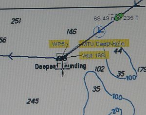
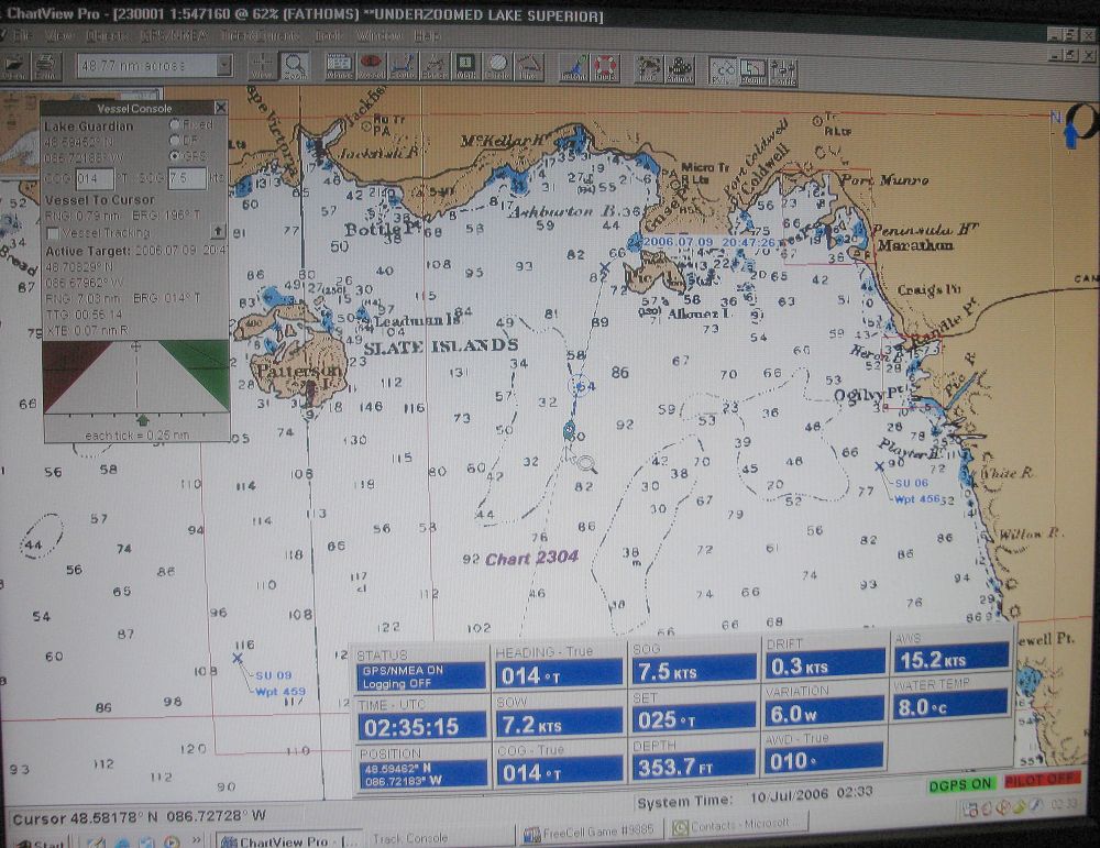
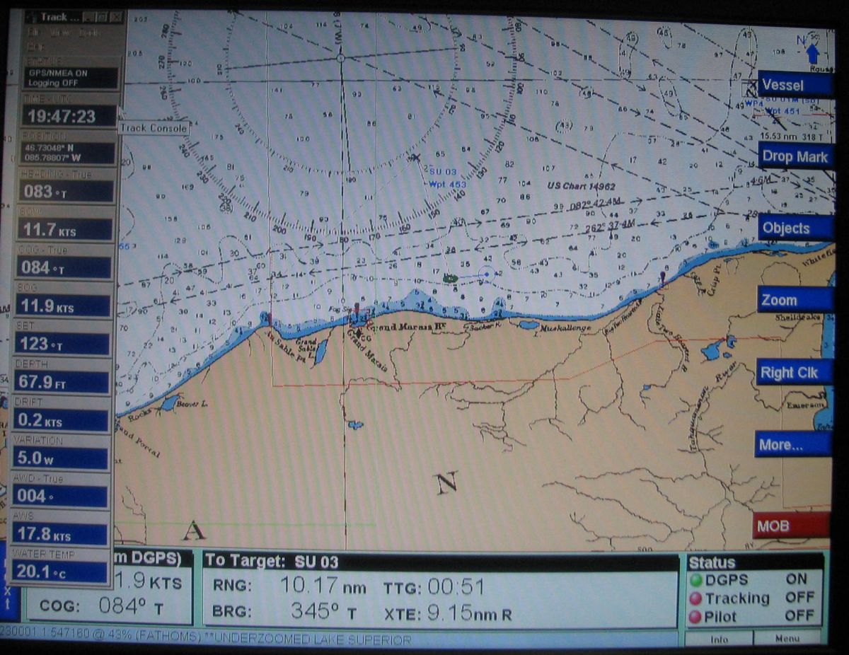
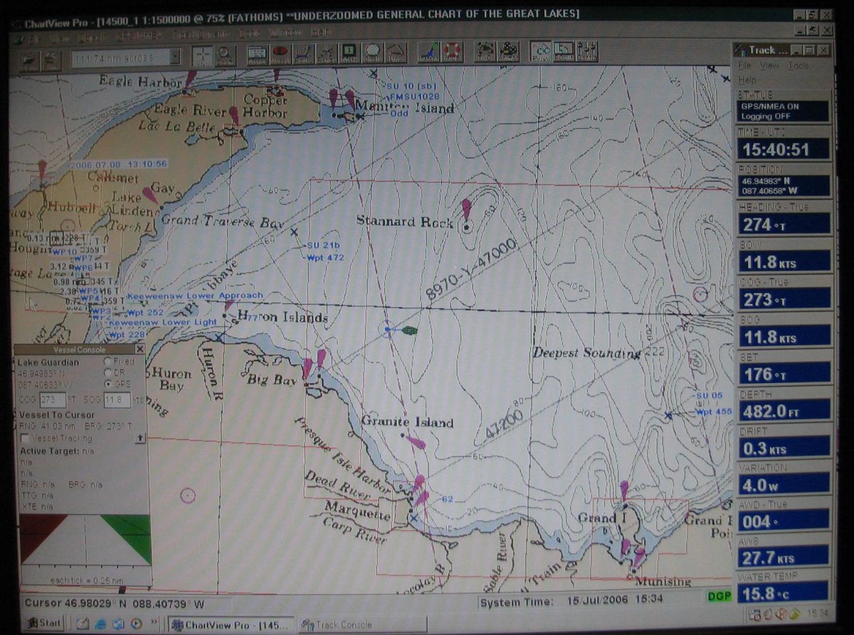
Over
the deepest soundings in Lake Superior, on the chart as 222
fathoms (1320 feet)
Movie shows view on the bridge and view of rosette coming
up from deep hole.
Click for MTU Deepest
Hole Video WMV 2Mb
|
|
|
Over
the deepest sounding in Lake Superior the ponar was used
to scoop up a sample
|
|
In transit
|
15
July 0800 hours to 15 July 1900 hours: Heading Home
- scientists and faculty are wrapping things up
and packing; final exams up on the bow; lots of sightseeing
as we move past the Huron Islands and enter Keweenaw
Bay; home is in sight; it's been an incredible
week, the experience of a lifetime for most of us; we
have collected a great deal of data and look forward
to processing and publishing it back home; unload; pictures;
say goodbye; feel sad to see the Lake Guardian steam
toward Duluth; hey, wait for me. |
|
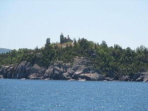
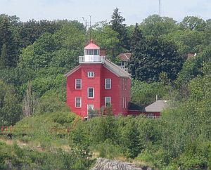
Huron
Island lighthouse
|
|
The captain
eases the ship towards the Michigan Tech dock |
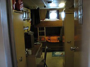
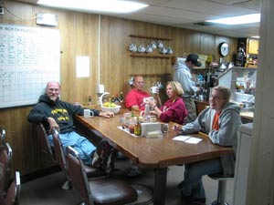
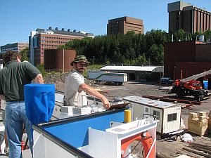
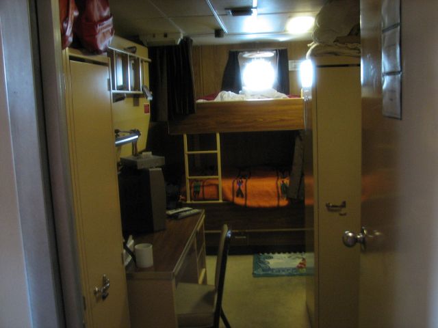
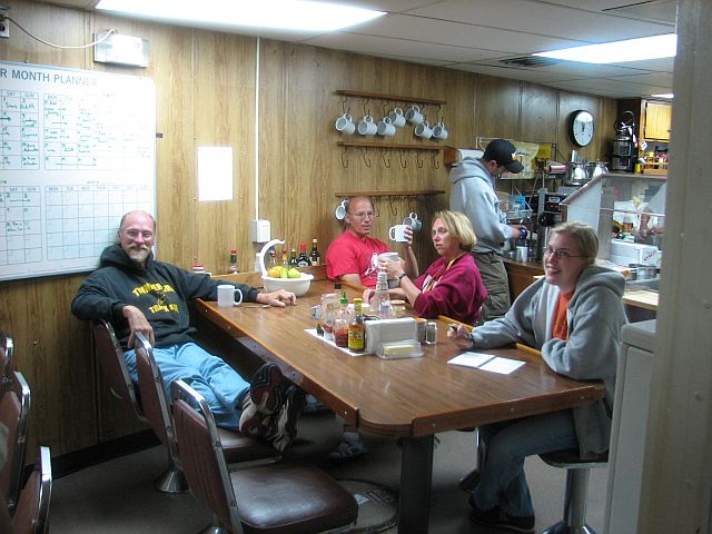
Spotlight
On: Shipboard Life - well, we did a lot of work and
we taught hard and listened well; but there were lighter times
as well; and heavier times that had little to do with science;
the food was great, the accommodations comfortable and the
captain and crew as welcoming and helpful as could be imagined;
a journey enriching to the spirit of those dedicated to the
life aquatic! |
|
|
|
|
Copyright © 2007
Civil & Environmental Engineering Department at Michigan Tech
|


